Area: 525 sq km (52516 ha), 2/3 of its territory falls to plain Pest and 1/3 to hilly Buda
Population:1 690109 people (about 17 % of the whole population of Hungary)
Population density: 3219 p/sq km
Religions: Roman Catholic 45%, other Christian 18%, unaffiliated 19%, Israelite 0,5%
Ethnic groups: Hungarian, Roma, German
Length (N-S): about 25 km (15 miles)
Width (W-E): about 29 km (18 miles)
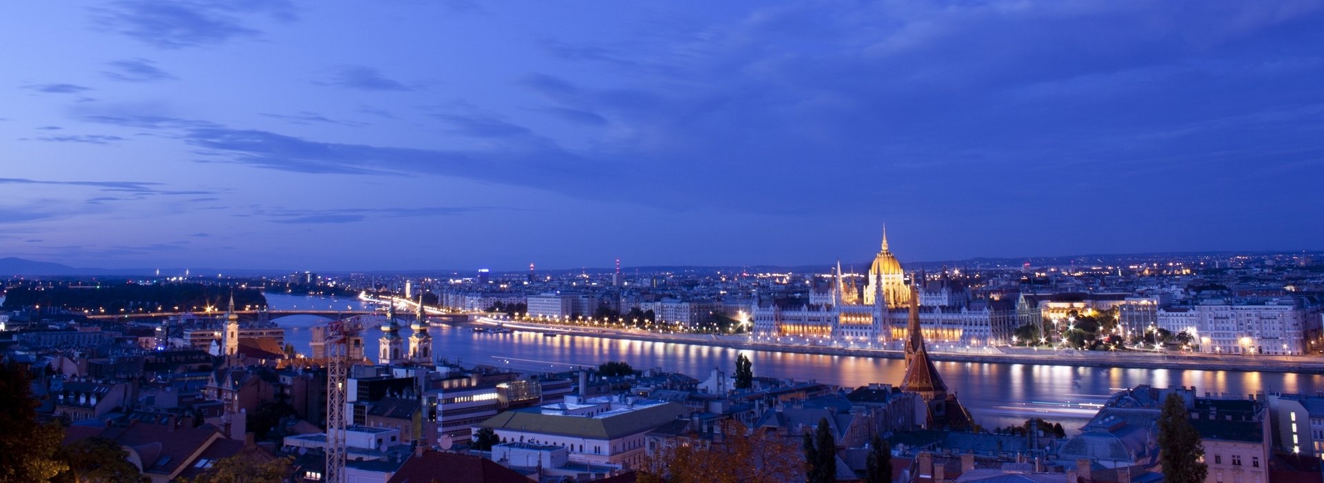
Lowest point: the surface of the Danube (96m above sea level)
Highest point: János-hegy (529 m above sea level)
Geographic coordinates: 47° 5'0" N, 19° 0'0" E
Climate: temperate; cold, cloudy, humid winters; warm summers; the number of sunny hours exceeds 2000 yearly, and the average temperature is 11 C°
Time zone: GMT +1 (CET)
GPS coordinates: 47.49571, 19.05507
National flag description: three equal horizontal bands of red (top), white (middle) and green (bottom)
Administration: 23 districts (the Roman numbers indicate the district) The historical quarters of the inner districts are the following: in Buda: the Castle (Vár), Tabán (I.), Watertown (Víziváros) (I/II.), Krisztinaváros (I/XII.), Gellért-hegy (I/XI.), Országút (II.), Óbuda (III.); in Pest: Belváros (Downtown), Lipótváros (V.), Terézváros (VI.), Erzsébetváros (VII.), Józsefváros (VIII.), Ferencváros (IX.). The names of the outer districts generally come from the name of the formerly separate settlements around the city, e.g. Újpest (IV.), Pestszentlőrinc (XVIII.), Kispest (XIX.) or Csepel (XXI.)
Number of bridges: 11 (9 for road traffic: Árpád híd – Margit híd – Széchenyi lánchíd – Erzsébet híd – Szabadság híd – Petőfi híd – Lágymányosi híd – Deák Ferenc híd - the two latter connecting the M0 ring around the city and 2 railway bridges)
Public transportation: BKV buses, trams, 3 metro lines, HÉV (suburban railway), cogwheel railway; other interesting means of transport: ferry boats, the Budavári sikló (Buda Castle Funicular), gyermekvasút (Children’s Railway) and the Zugligeti libegő (Zugliget chairlift)
Main railway stations: Nyugati (Western), Keleti (Eastern), Déli (South) and Kelenföldi pályaudvarok
Airports: Ferihegyi nemzetközi repülőtér (Ferihegy International Airport) with 3 terminals 15km from the city centre: Ferihegy 1 receives discount airlines, Ferihegy 2A terminal is for planes within Shengen area, terminal 2B is at the disposal of the non-Schengen airlines.
Tipping: accepted at 10% rate in restaurants, at the hairdresser’s, for taxi and other services